9.28.2007

WEEKEND READING: September 22-28, 2007

Lots of good reading for this weekend. Don't miss Item Six if you're a fan of absurd humor.

ITEM ONE: Deputy Dog (photo credit) went all out on this post about where different vehicles go once they are decomissioned. Kind of makes me wonder if there's a forest of defunct CTA train cars somewhere in Chicagoland...

ITEM TWO: According to APTA, "when compared to other household actions that limit carbon dioxide (CO2), taking public transportation can be more than ten times [more effective] in reducing this greenhouse gas."

ITEM THREE: I *heart* Jane Jacobs, but I really strongly do not *heart* how her message has been co-opted and bastardized over the years. This wonderful and succinct piece from New York magazine sets the record straight. (Found via Neighbors Project's excellent daily Neighbor News report -- a must-read for anyone interested in gentrification!)

ITEM FOUR: A trust fund for affordable housing, first proposed in the 1980s, may finally be on its way to becoming a reality. (Here are some more good ideas about the subject).

ITEM FIVE: Wendy Waters speculates about an urban baby boom over at All About Cities.

ITEM SIX: Some guerilla urban art on the CTA trains that'll give you a good laugh. Cut, paste, and try it in your city. The more ridiculous, the better!

ITEM SEVEN: Can Second Life actually improve real-world physical environments? Here's the first compelling argument I've read that says "yes."

Have a great weekend!

(Photo from Flickr user shadeofmelon.)

9.27.2007

Bizarrchitecture

Rising 177 feet over the Argentine city of Mendoza is Edificio Gomez (built in 1954), which is one of the most...interesting buildings I think I've ever come across.

Before we get into Gomez, though, a bit of background on Mendoza. The city, home to approximately 111,000 people (with 850,000 in the metropolitan area), is located at the foot of the Andes and is known for its exquisite beauty -- it's nickname is "The Oasis City." It started out in 1561 with the traditional 5x5 block town plan surrounding a central square and Catholic church that the Spanish used for basically every city they built when colonizing South America. The dimensions of this plan (streets, sidewalks, lot sizes) were notoriously rigid, leading to a rather uniform look to the central areas of many South American towns. But when a massive earthquake leveled Mendoza in 1861, it was rebuilt with much more generous spatial allottments. Sidewalks and streets were widened, trees were planted, more expansive plazas laid out, and one of the city's most unique features -- a series of stone irrigation ditches that run along the streets to water the trees -- was created. In fact, Mendoza is considered by some to be the most beautiful city in Argentina -- a steep claim, considering that this country can claim the likes of Salta, Tucumán, and Buenos Aires (the Paris of the Americas).

So, with a reputation like that, how does Mendoza explain Edificio Gomez? Just look at this thing. It's...I don't even know what it is. It's bizarrchitecture, that's for sure. The verticality of the campanille is impressive...I'll bet the thing looks three times its height from the sidewalk. Or at least it would if the architect hadn't wrapped it in an industrial riverfront warehouse from Cleveland circa 1940. Seriously, what is that? And then there's the crown, which is...it's just sublime. The above photo was the first image I'd ever seen of the tower, with the crown peeking over the trees in the central Plaza España. Without the bulk of the building, the crown has an instant "Holy hot spiky messes, Batman, what IS that?" effect. It looks like the bastard child of Antonio Sant'Elia and Fritz Lang. Or of their buildings, anyway. Whatever. Words fail.

From what I can gather, the building was designed by someone named Civit, who "based" it on the art deco towers of 1920s Manhattan. At first, when I read that, I got excited at the prospect of the Forgotten Continent (oh please, everyone both knows and cares about Africa; but who can find Bolivia on a map?) coming complete with its own forgotten Insane/Visionary Modernist Architect With a Vaguely Industrial-Sounding Psuedonym (Corbu del Sur!). Alas, the guy's full name was Manolo Civit. How droll.

Honestly, I am totally crazy about this building, and I can't really figure out why. It doesn't even really fit in the ugly-chic category that Jean Nouvel has been blazing a trail through lately. It lacks the self-awareness and the extra three pieces of flare. Perhaps it's the fact that it's utterly unique? Or that it looks like the watchtower-clubhouse of an eccentric and reclusive manchild? Or that they light it up at night like some kind of baroque prison Christmas tree? I don't know. It could be any of those things. I just know that I like what I see.

There have been several recent articles and blog posts listing the authors' nominations for the world's ugliest buildings, and I think that it's worth noting that Edificio Gomez didn't make any of them. Granted, that might have something to do with the fact that it's an extremely obscure building from an obscure city in a country that I'd be willing to bet at least 50% of "US Americans" have never heard of...but let's give Gomez the benefit of the doubt and say that it missed the lists because it is not, in fact, ugly. Instead, it is just completely bizarre. And really, that's much more fun anyway.

At any rate, stumbling on the Edificio Gomez has me wondering what other wacky architectural curiosities are hiding out there in the gazillion little cities around the world that I've never heard of. Is there such a thing in your city? If so, please share. In the meantime, let's enjoy Gomez in all of his...erm...glory.

(Photos from Panoramio users Emiliano Homrich [1] and Leandro Luis Targon-Gomez [3], and Flickr user elpollo [2].)

Empty Cities

Speaking of Singapore (as I was earlier today), the August/September 2007 issue of Polar Inertia features a series of photographs of momentarily abandoned commercial spaces taken throughout the island metropolis by Heman Chong. As the photographer explains: "The idea for this series is to document shops in shopping malls in Singapore at moments when they are completely empty. The eerie emptyness presented in the photos is a spectulative essay on the fantasy of walking through shopping malls and not encountering anyone. This photographs are taken without any prior consent from the owners or any kind of setup or planning. Considering the density of the city (4.5 million citizens on a really small island full of shopaholics), its practically an impossible feat at times."

The photos in "The Abandoned Singapore," as the set is titled, really do a wonderful job of capturing a very eerie, almost post-apocalyptic feel. After three or four pics, you start to feel uneasy...somewhere around ten or twelve, a shiver runs down your spine. By the time you reach the supermarket image above, you'll want to look out your window just to make sure that there are still people walking around; that you haven't woken up on a deserted planet.

That feeling reminded me of a post at Interactive Architecture dot Org that I read earlier today about digital architecture and "information pollution" (you would think there'd be a convenient portmanteau there...I've tried, though, and nothing quite rings true). The post made mention of the now near-legendary law passed at the beginning of this year in São Paulo which banned all advertising -- or what the mayor called "visual pollution" (much less interesting term, that) -- from the city's notoriously cluttered streetscape. IAdotO explained how "the city of approximately eleven million people, South America’s largest, awoke to find a ban on public advertising. Every billboard, every neon sign, every bus kiosk ad and even the Goodyear blimp were suddenly illegal."

I am thoroughly bemused with the way this event has been described in the media (where I'm guessing IAdotO picked up the language), as that is at least the fourth or fifth time I've seen the word "awoke" used in referrence to the day the law went into effect. Paulistanos were apparently came home after a night out celebrating the new year and were lulled to sleep by the buzzing of a thousand tubes of neon and argon, their rooms glowing dimly from the ambient light of a million backlit fiberglass logos filtering through the thin curtains...only to awake the next morning to find that the sinage had simply disappeared. Ad Rapture!! Millions of golden arches and blue half-torn movie tickets and silver apples snatched up into the clouds in a blast of white light, never to be seen again (or at least not until they land in a tech dump in Guiyu). É impossível!

My brain is wandering now, because it's late...but isn't that a fantastic image? I really do love it.

We end tonight with a more tangible image from another set from Polar Inertia; the zine has a compillation of photo collections from the LA/SoCal area, including a set from March of 2006 called "Oblivion." Photographer David Maisel depicts Los Angeles in unnerving inverted black and white. It gives the city a sort of desolate, alien appearance...and it's gorgeous. Maybe this is how LA was supposed to be viewed all along...


Links:
Polar Inertia
- The Abandoned Singapore
- Oblivion

MediaArchitecture - Media Urbanism (IAdotO) (Oh, do read this one! I sort of did it a disservice by pulling one tiny, irrelevant detail from a very solid post, so I am counterbalancing that by insisting that you follow this link).

9.26.2007

Framing Urbanism

Anyone who lives in a city is a student of urbanism. We have the choice of whether or not to pay attention to the lessons we are being taught, but they are taught either way. Every day of living in a city is a chance to learn about how the place works. So it helps to have a way of organizing the observation process.

That being said, I came across an organizational tatic of which I am particularly fond recently on re:ACT, a blog run by a dozen architecture students in Singapore. Ronald Lim, one of the re:ACT bloggers, put up a post entitled "My Wishlist for Architecture in Singapore." It's short (five items), practical, and the objective is very clear even without being directly stated. That objective is to make Singapore into a more architecturally conscious city, to improve the quality of the buildings being designed there by improving public awareness of architecture and design. Lim calls for an architecture and design department at the Singapore Art Museum, an annual competition similar to PS1 or the Serpentine Gallery, and an interesting set of tax incentives (among other things).

The benefit of having such a list, as an individual observer of a specific city, is that a person can identify what it is they are looking for in terms of an area's strengths and weaknesses. It's a framing technique, really. But a wishlist is especially helpful, I think, because it gives a person something to look for when visiting other cities. Even more than framing how one sees one's own city or even one's neighborhood, it frames how one approaches the urban form in general. This is beneficial because it allows the observer to absorb information from one place and take it home with them, using it to enrich their own city.

I've always thought it'd be really interesting to see a neighborhood group do this kind of thing, collectively. The common perception of the Neighborhood Association or Block Group is that of a stodgy, reactionary coalition of anti-growth crumudgeons with pickett signs and way too much time on their hands. Rather than hearing moaning and groaning about the death of a neighborhood's precious, precious character every time someone so much as proposes to trim their hedges, it'd be fascinating to see how a group might impact their community by identifying what defined the character that they were trying to preserve and coming up with a wishlist of ways in which that character could be strengthened and enhanced, and maybe even improved. Imagine a neighborhood group that actually courted developers to help achieve their goals of enhancing the architectural character of a neighborhood, welcoming and even helping to speed a long the process of approval for a new building in exchange for architectural sensitivity and some streetscaping improvements.

I wouldn't be surprised, actually, to hear that this has been or is being done. In fact it would be great to hear stories of this kind of thing; a neighborhood threatened by the dreaded gentrification beast working with developers instead of against them. I wonder how that works out...are the neighbors better off in the end, or do they wind up getting screwed over time? I'd be willing to bet on the former, but I'm open to arguments for the latter...

***

By the way -- while we're on the topic of taking observing what other cities are doing right when traveling, if you haven't heard of Civic Tourism yet, check out the link below. It's a great concept, and it seems like the kind of thing that could really give some extra oomph to your next urban vacation.

(Photo from Flickr user Erik Sevilla Estrada.)


Links:
My Wishlist for Architecture in Singapore (re:ACT)

Civic Tourism

9.24.2007

Why Do We Build Cities?

Against all odds, more than half of the citizens of New Orleans returned to their broken city after Hurricane Katrina to try to repair their homes and their communities. The process has been notoriously difficult, as the media continues to report, yet New Orleansians press on, living in FEMA trailers or under tarp roofs and trying to make sense of the legal nightmare of applying for aid.

Meanwhile, down in Pisco, those who lost their homes in the recent earthquake are starting to rebuild their adobe houses without any kind of supervision or safety regulations, Peruvian officials worry. At least part of the motivation is economic, as one can only build on the land that one owns or can lay claim to. These people need shelter, and they're addressing that need. But with the government promising aid and training for people rebuilding their homes, there is the suggestion that there is some other motivation, something below the surface, that is causing people to rebuild so quickly.

In fact, the rebuilding processes in both New Orleans and Pisco raise some interesting questions about the nature of urbanism. Why do these people rebuild instead of moving elsewhere? And if a city must be rebuilt, why start over in the same place? Why not build a new city in a place less prone to, say, flooding or earthquakes? What's the reasoning behind trying to rebuild a city that has been knocked down?

There is a social aspect to urbanism that underscores all of the other motivations for urban development. People, as has been well-documented by sociologists, generally like to be around other people (at least in close proximity, even if there is no direct interaction). Still, we generally think of cities merely as concentrations of power (both economic and militaristic) instead of what they are, literally: concentrations of people.

If our settlements can be leveled by natural forces regardless of size, and if their economic structures can be so easily toppled, why don't we all live in small towns or villages? They'd probably be easier to rebuild. They wouldn't be such a hassle to manage. In fact, one could make a convincing argument that a society made up of small towns, even operating with current technology, would be more sustainable than one composed of large cites.

So why the heck do we build cities, anyway?

A few weeks back, a research consortium with participants from Harvard and Cambridge Universities (among others) shared some interesting new findings from the excavation site at Tell Brak -- findings that seem to tell us a lot about the origins of urbanism. The researchers have found, by analyzing fragments of pottery scattered around what was essentially a core city, that the urban area around Tell Brak was developed in an organic way that suggests an entirely different reason for the founding of mankind's earliest cities.

Traditionally, the founding of these early cities has been attributed to various kings and religious authorities. In an article about the new findings, Scientific American quotes researcher Jason Ur: "Kings were quick to take credit for founding cities...We're taking royal inscriptions at their word, which could be a bad thing to do."

The informal growth of Tell Brak seems to suggest that, at their very beginnings, cities were founded because they provided a strong social network. This undoubtedly created economic and military power as early cities grew, but the original impetus was simply for people to gather in one place in order to improve their lives in some way (the researchers acknowledge that individual motivations were likely diverse). So Tell Brak illustrates at least one compelling argument for why we build large, impressive urban centers: we just like to be around each other.

In wrecked cities like New Orleans and Pisco, the large majority of citizens don't return because they look forward to the immense challenges of cleaning up environmentally devastated lots, tearing down the shards of their old homes, and rebuilding from scratch. They return because they are looking to rebuild the social places that existed before their city was ruined. They rebuild for the same reason that anyone builds in the first place.

They just like to be around each other.

(Photo from Flickr user mateollosa.)


Links:

Pay Heed to New Orleans' Plight (Associated Press)

Citizens in Pisco, Peru Informally Build Adobe Houses after Earthquake (LivinginPeru.com)

Ancient Squatters May Have Been the World's First Suburbanites (Scientific American)

Researchers rewrite origins of the urban sprawl (University of Cambridge)

9.21.2007

WEEKEND READING: September 15-21, 2007

The weekend has arrived just in time!

ITEM ONE: CityStates debunks Wendell Cox's article, previously discussed at Where, on the CityStates blog.

ITEM TWO: IDEO's reimagining of the street cafe, via GOOD Magazine. (Photo credit)

ITEM THREE: Chicago is turning out to be a rather tiresome city that lives up (or down) to its muddled quality of life ratings by utterly forsaking its residents in favor of attracting more tourist dollars to fund more TIFs for million-dollar condos. That was me pontificating, but check out Item Three for the most recent bit of proof.

ITEM FOUR: Cleveland is taking community development down to the block-level.

ITEM FIVE: I have heard of Miss Representation many times...it is a blog that pops up frequently in meta discussions about the archiurban blogosphere. And yet, I had always avoided it since I thought "Eh...
another blog about New York. Who gives a rat's?" And then I actually read it and realized that it's some of the funniest architectural writing...well, ever. The moral of this story is: don't be a twit like me. Read Miss Rep. Start with this new post on the hapless mess that is Ground Zero.

ITEM SIX: Cities of Theory is another great blog to add to your reader. Here we have a post on creating enjoyable urban places...

ITEM SEVEN: Speaking of quality of life, Cuba's all like "Hey guys, check me ouuut!"

Oh...I think you can tell that I am in need of some r&r. Y'all come back now, ya hear?

9.19.2007

Festival of Maps Update

The Festival of Maps is getting underway here in the Windy City, and one of the most exciting developments is that of the FoM's shiny new website! Complete with an interactive map of exhibits, a full schedule (it's even bigger than I'd thought it was going to be!) and a list of events broken down by sponsoring institution, the new website is a valuable resource for anyone visiting Chicago and looking to catch some of the action.

The FoM's website highlights a number of exhibits that are currently up and running, including the recently updated "Capital of the 19th Century: Paris in Maps" mini-exhibit (the first part was profiled here last month), and the "Grammar of Landscape" exhibit at the Illinois State Museum's Chicago gallery, among others. The FoM also has a new logo, and the Where/FoM logo (seen above) has been modified to reflect that.

This weekend will see the opening of the Chicago History Museum's "Mapping Chicago: The Past and the Possible", so keep your eyes peeled for a forthcoming Whereview. (Look, ma, it's a portmanteau!) Where will continue to cover the mappy action as it unfolds, so do check back from time to time to see what's doin' in Chicago.


Links:
Festival of Maps

Capital of the 19th Century: Paris in Maps (AI Chicago)

Grammar of Landscape (IL State Museum - Chicago Gallery)

Mapping Chicago: The Past and the Possible (Chicago History Museum)

9.18.2007

Conveyer's Subjective Atlas of Jersey City

Josef Reyes, the publisher/editor of Conveyer, was kind enough to send me the latest copy of the zine that, in Reyes' words, "[attempts to articulate] Jersey City's 'sense of place' by documenting snatches of daily life in the city. The idea is that by examining how people experience the city on an everyday basis, we get a vivid picture of what the city really feels like."

Overall, Conveyer is a very thoughtful read, but my favorite part came right at the beginning; "A Subjective Atlas of Jersey City" is made up of four maps, hand drawn by individual JC residents, accompanied by photos of the places marked and explained on the maps. It's likely that this has been done somewhere before, but that hardly lessens the impact of the article. This simple mapping out of different peoples' experiences of the city, as disparate as they are, helps to form an idea of what it might be like to live in Jersey City.

Reading about urban design projects or shiny new buildings or traffic problems in cities scattered across the globe is easy enough to do; that is to say, there's no shortage. Nor do we lack stories on what it's like to visit these disparate places; if anything, there are too many stories about what it's like to be a rich tourist in a foreign city. But the stories that seem hard to come by are the ones that tell us what life is like, day to day, in a given place. What, we are left to wonder, are the places with these fabulous buildings, avenues, and metro stations really like for the people why actually use them?

In its mission to shed some light on this question for Jersey City, Conveyer succeeds most readily with the "Subjective Atlas." It's a really lovely collection, and it manages to convey (oops, a pun!) a great deal of meaning in a relatively short space. The places that the reader learns about through the maps become almost personal; the vicarious experience of the reading scratches the same itch as reality TV...yet it does so in a much more satisfying way. The maps are scripted, in their own way, but this is done by the person whose life we are peeking into, not for them.

Jeff Edwards' map depicts the neighborhood where he and his s.o. Amy were living in September of 2001. Edwards makes his own experience of the 9-11 attacks real by using the context of his former community to illustrate how he grappled with the effects of what happened that day. We learn about the place by learning about the people who live[d] there. The last marker on the map, at the bottom of the page, is an arrow pointing away from the neighborhood. "On the first anniversary of 9-11, [we] were working on a condo we had just bought. Our new neighborhood is this way. Sometimes we miss the old one." And I couldn't help but think, as I turned the page, that I kind of would, too.


Links:
Conveyer (Image credit)

9.14.2007

WEEKEND READING: September 8-14, 2007

I'd be lying if I tried to pass off a near-postless week by saying I'd been busy...I've been in hardcore daydream mode. Next week we'll return to our regularly scheduled programming...I think. :-) For now, there is weekend reading...

ITEM ONE: Pruned reports on the fascinating Seuthopolis project in Bulgaria, complete with some super imagery.

ITEM TWO: Speaking of imagery, Curious Expeditions has come up with an exhaustive photo collection of the world's most stunningly beautiful libraries (including Milan's Biblioteca Di Bella Arti, pictured above).

ITEM THREE: Planning a trip to a Developing World country? Stuff Your Rucksack.

ITEM FOUR: The Russians are apparently having baby making contests now. Hmmm...

ITEM FIVE: Norman Blogster over at Part IV introduces MIMOA with some superb sardonic wit.

ITEM SIX: New Monu! The topic: "Second-rate urbanism".

ITEM SEVEN: A great NY Times article on DC's promising new mayor, Adrian Fenty.

Enjoy your weekend!

9.11.2007

Clarity

Generally, the only personal information you'll get about this blogger is my opinion on some urbanism-related issue. That's not to say that I take myself too seriously here; let's be real -- I'm no professional. But it seems incredibly disingenuous to write about the 9/11 terrorist attacks in any sense other than personal. It also seems odd to write about anything else today. Perhaps that's just a part of the cultural PTSD Americans are going through; we aren't haunted day in and day out, but once a year we all feel a yearning to share our stories about "that day" with each other. Even more interestingly, it's a day when most of us will actually listen to what one another have to say. At any rate, if you don't want to listen to my own account, consider this your fair warning.

And so.

I was still living in the Milwaukee area six years ago on the day of the attacks on the World Trade Center and the Pentagon. I was away when from the television when the second plane hit, as well as when the towers fell, so the most potently visual events of the day will never be as vivid for me, I don't think, as they are for many Americans. I remember what happened, but not as it happened. September 11th is, for me, a day of video replays. I saw the images a million times before September 12th, but what happened has always felt distant to me.

In fact, what I remember most vivdly from the whole ordeal came several days after September 11th. There is a massive church in the hills to the northwest of Milwaukee called Holy Hill. Perched atop -- you guessed it -- a hill, the building's two steeples dominate the rural skyline for miles in every direction. One of the towers has a public observation deck, and I traveled out to Holy Hill with two friends on the Friday after the attacks. There was no particular reason for the trip; we were bewildered by what had happened, and were perhaps looking for that musty feeling of sanctuary that religious buildings can provide.

I had been to Holy Hill once before that day with my family, and I remembered being able to see Milwaukee's stubby little skyline, over 25 miles away, enshrouded in a typical urban haze. On the Friday after the attacks, when I returned to the steepletop room with my friends, the skies were the perfect blue of early autumn, and the urban haze that had hung over the city was vanished; the air was quiet in a way that changed my understanding of that phrase. Planes had been grounded for days, of course, and as a result the view from the tower was so clear you could practically see the windows of the individual buildings in the skyline. For some reason, that image of the city stretched out at the point where the early reds and oranges of the very leafy metro area dropped off into Lake Michigan (also visible from the tower that day) has always stuck with me.

Whenever I think back on the September 11th attacks, I remember the confusion and the anxiety that followed, while the attacks themselves border on the abstract, like a never-quite-forgotten childhood nightmare. And whenever I find myself in a position now that causes me great confusion and anxiety, I use the memory I have of the view from the tower at Holy Hill to remind myself that, oftentimes, tragedy and struggle can wind up clearing things up in a way that I had never expected.

Perhaps that's too literal of an interpretation; perhaps, as many are arguing lately, enough time has passed that emotional license has revoked for people writing about September 11th, and I've just made an ass of myself by adding to the pile of endless and unncessary pontification; perhaps this post is entirely off topic and completely inappropriate. Still, I felt compelled to write it.

I live under a flight path into O'Hare, and as I write this post I can hear jets flying overhead. Most days I don't notice, but today is different.

9.09.2007

Last-Minute Weekend Reading Addendum

Very last-minute...in some parts of the world, it's already Monday!

Nevertheless: loud paper is back. Now in blog form, complete with an RSS feed and extra marshmellows! (Kidding about the last one.)

(Via Archinect and Varnelis)

(Photo from Flickr user crazybobbles.)

9.07.2007

WEEKEND READING: September 1-7, 2007

It has been a busy week at Where. The last couple of days have been slow news days, but there was a glut of good stuff earlier in the week. Here are the highlights...

ITEM ONE: Airoots has posted the most eloquent lament of New York's homogenization yet...

ITEM TWO: ...and the authors' following post, on the fluidity of Tokyo nightlife, confirmed that airoots is, in fact, the best urbanism blog that you're not reading yet.

ITEM THREE: A new urban issues zine, The World Edition, is up and running this week with articles from founder Alexander H. Johnstone, Archidose's John Hill, and (in the interest of full disclosure) me. Heh.

ITEM FOUR: Gran Raccordo explains why New York is actually Pittsburgh.

ITEM FIVE: The AHI blog takes a look at what the recent presidential election in Turkey will mean for affordable housing in that country.

ITEM SIX: Mark the date - Wikicity Rome takes place tomorrow (Saturday, September 8th).

ITEM SEVEN: BoingBoing covers the fascinating Homeless World Cup, which is exactly what it sounds like.

Have a great weekend!

(Photo from Flickr user diebmx.)

9.06.2007

Why "Smart Growth" Isn't

"Smart Growth" (henceforth "SG") is a grossly misused term these days. Almost exclusively used to describe slightly modified suburban development -- moderately smaller lots, more narrow streets, excessive subsidies, "walkable" "communities", and those detestable Towne Centres all come to mind -- the term is a bit of old fashioned semantic smoke and mirrors. The promise is that we can continue to build much as we have for the past fifty years if we consume a couple less farms, or if we move things just a little closer together. Of course, the fact is that these minor changes are producing minor results.

The danger here is twofold: on the one hand, "SG" advocates and the people who choose to (and can afford to) live in "SG" developments pat themselves on the back and insist that they are doing their part to save the world from global warming, when in fact they have made very little difference (and are probably likely to make it up through other small indulgences with which they congratulate themselves for being such good citizens); even more foreboding is the fact that the failure of these not-so-smart "SG" projects provides the pro-sprawl, anti-transit crowd with ample ammo in their arguments against not only "SG", but cities and urbanism in general.

Case in point: a recent article by Wendell Cox of Demographia for the Toronto Star highlights the inability of "SG" initiatives, with their emphasis on (barely) higher density and driving less (sometimes), to curb greenhouse gasses. This is no surprise for reasons discussed above. But the article also cites a University of Sydney study that makes the deceptive argument that dense, transit-linked city neighborhoods produce higher levels of greenhouse gasses per capita than sprawling suburbs.

If this seems counterintuitive, that's probably because the findings are slanted. It is true that Inner Sydney has the highest per capita outpot of GHG, but there is no mention of the fact that a huge chunk of this area is taken up by office towers, which consume massive amounts of energy for heating and cooling, thousands of acres of fluorescent lighting, and other energy-consuming systems that often continue running long after employees have left for the night. Being the central business district, Inner Sydney is also the destination of much of the auto traffic that originates in the surrounding sprawl. Outside the CBD, other neighborhoods include other offices and large tracts of industrial land (and factories are often very large producers of GHGs) that are much less likely to take up space in more far-flung areas.

Of course, 43.3% of the eco-footprint for the average New South Wales resident is created by the hugely disproportionate costs for importing food. This gets at the true heart of the problem facing cities and suburbs around the globe: the need to live locally. Of course, neither the pro-"SG" crowd nor its detractors talk much about that.

More on all of this "SG" business next week...

(Photo from Flickr user pfrench99.)


Links:
Planners denying reality (The Toronto Star)

Australian Conservation Foundation's Consumption Atlas

Typing Utopia

An excerpt from the article on São Paulo highlighted in last Friday's Weekend Reading post:

But while the city of enlightened tropical urbanism – housing blocks with masses suspended over open breezeways, free-form plantings, walls of vertical wood blinds, beautiful decorative ceramic brises-soleil and elaborate mosaics – is occasionally visible [in São Paulo], it was overtaken by incremental failures to live up to the promise. The sunny future imagined in the 1950s succumbed to the repression of the 1960s and ’70s and the economic disasters and neo-liberalism that followed. Today the disparity between inconceivably rich and unimaginably poor is creating a new cityscape. A simmering low-grade siege mentality has become an everyday fact of life, and as a result the city is gradually obscuring its confidence behind multiple layers of improvised urban fortification and strategies of avoidance. Sampa is increasingly segmented, festooned with surveillance cameras and a boggling variety of gates, barriers, photoelectric tripwires and enclosures defended by an army of private security guards. If left unchecked, warns Brazilian anthropologist Teresa P.R. Caldeira, this metastasizing de facto topography of exclusion and suspicion will lead inevitably to the implosion of modern public life and the values of civil society.

This evolving mess, which nobody planned and no one wants, is the crux of Angela Detanico and Rafael Lain’s Utopia font. Trained as graphic designers and practising as artists, the duo have created a pictographic alphabet (which can be downloaded from their website4) in which the upper case is represented by silhouetted glyphs of Niemeyer or Niemeyeresque architectural icons and the lower case by some of the more grimly prosaic elements of contemporary Sampa. Using the font, typing even the most harmless text can become an exercise in creating unintended disorder and blight. In the end, the reality of the street scrimmage between public and private trumps the best intentions of any planner.


Welcome to CyberSampa:


Links:
Detani Colain

9.05.2007

Build, Rebuild, Build Anew

One of the best articles written about New Orleans' progress (or lack thereof) two years after its tango with Katrina has come from within the Crecent City, itself. Nola.com's article by Doug MacCash, entitled Architectural Soul of the City at Stake, discusses in great detail the efforts of preservationists to save the city's pre-hurricane architecture; and that label is very deliberate, as there is a general push to save anything, be it from the 1800s or the 1960s, that survived Katrina and the resulting floods.

MacCash's article has particular resonance because it so very subtly ties New Orleans' architectural soul to its overall civic soul; indeed, the city's identity, now in crisis, is intrinsically tied to its built environment. New Orleans faces the intractable problem of having to build, to rebuild, and to build anew. That is to say, NOLA must replace destroyed buildings (build) without further damaging -- and trying to maintain -- its legendary sense of place (rebuild) in a way that avoids painful, regressive kitsch (build anew). This explains the desire to save everything -- no matter the architectural style -- that wasn't truly irreparably damaged.

John Magill, a historian with The Historic New Orleans Collection, is quoted in the Nola.com article as saying "There are so many houses lost. Nobody can comprehend what's gone." This quote is particularly telling because it refers not to Garden District mansions or classic Victorian shotguns, but to the so-called "slab city" neighborhoods built in the post-war era. Magill's lamentation is for the brick-veneer bungalows that can be found blanketing suburban tracts from Seattle to Atlanta, but that "meant a great deal to the people who lived in them." The point being made here is that what has been decimated in New Orleans is not just a physical vernacular, but an emotional one as well. A page of the city's cultural story has been savagely ripped from the binding.

But the name of the game on the bayou is Resilience, and the destruction of New Orleans has presented a dream scenario for architects and urban designers. Visions for the city's future have not been scarce, though traction with public officials, unfortunately, has been. Still, they continue to come pouring in. Most recently, Thom Mayne's National Jazz Center and TEN Arquitectos, Hargreaves Associates, and Chan Krieger Sieniewicz's reimagining of the downtown riverfront have added some lustre to the city's architectural news roster.

Of course, the reality is that these projects could quite possibly fizzle out like their predecessors. "Still," a NY Times article on the proposals points out, "the scope and creative ambition of these projects suggest how architecture could someday be vital to the city’s physical and social healing. Both seek to transform dead urban areas into lively public forums, employing powerful architectural expressions of a democratic ideal."

New Orleans hasn't been a center of contemporary design since "contemporary" refered to the kind of flowery aesthetic that makes today's historicists salivate. In the wake of an event that has changed the very way in which the city thinks about itself, there is a chance that this could change. In fact, while the artistic merits of modern architecture (as with any style) will forever be argued, with its clean lines and frank honesty modernism is (metaphorically speaking) exactly what the city needs

Trahan Architects have come up with what may be the most enticing endorsement of modernism in the new New Orleans with their impossibly sleek update of the city's most beloved piece of vernacular: the shotgun house (pictured above). If built, this house would be a new, flood-conscious building that could easily nestle into a newly cleared lot (build) that draws from the city's architectural and cultural tradition (rebuild) in a way that is neither chintzy nor dishonest (build new). This is democratic architecture at its best.

People will always be wary of buildings built in newer styles of architecture because they suggest, whether it's true or not, that the places around them are changing. But New Orleans is a city that can not afford to deny change, and it can likely be agreed that, after Katrina, it would be particularly bullheaded to do so. Modernism is certainly not the answer to every problem facing this city, and shouldn't even necessarily be the primary architectural mode in the city's reconstruction. But embracing innovative and progressive architectural values, in a place where architecture is so vital to the civic character, can help to bring about important changes in a city desperate for a new raison d'être. The people of New Orleans cannot rebuild simply for the sake of doing so; the hurricane has given them an incredibly rare chance to create a built environment and a community that together form something greater and stronger than the insular, stagnant city that they had before.

It's time to consider building change into the vernacular.


Links:
Architectural soul of the city at stake (Nola.com) (found via Life Without Buildings)

Two Infusions of Vision to Bolster New Orleans (NY Times)

Trahan Architects (Photo credit)

9.04.2007

The 21st Century Park

“A 21st-century park is something very different from what Frederick Law Olmsted imagined when he won the competition for Central Park in the 19th century. We have the Internet, we have computer games, we have people flying to Hawaii for vacation, so a park in the 21st century has to be a wholly new kind of thing...I hope that we cast a wide enough net to get truly the first park of the 21st-century. Shelby Farms is certainly big enough to be something very special.”

This little nugget of hubristic bombast comes from Alex Garvin, a former LMDC official (*ding*, red flag), in reference to his current project: a revamp of Shelby Farms Park, currently a twinkling RFQ in Memphis' eye. As it stands, the 4,500 acre park is currently used for a variety of recreational activities, as one might expect for such a huge space. The Shelby Farms Park Alliance describes the park as encompassing "lakes, paved and unpaved trails, forests, meadows, an Agricenter, a farmer’s market, a horse arena, a visitor center, rental horses, skate boarding, disc golf, dog off-leash area, senior gardens, a natural area with a river running through it, a restaurant, government offices and even a prison."

Heh...someone really knows how to end a list and start a party.

At any rate, Garvin was originally brought in to develop a master plan for the park that one can only assume was originally intended to have some sort of developed component. But Garvin's suggestion was to shape the rough natural spaces into the majestic, high-tech Versailles of the Future described at the start of this post. So now the RFQ is calling on L-archies big and small to come up with a way to turn a subdivision-ringed area that claims to be the largest urban park in America into a fully-functioning greenspace-masterpiece-extravaganza. Sounds like a thunderous disappointment waiting to happen, no?

There is naked ambition evident in Garvin's blustery prophesy of trailblazing landscape architecture; the Shelby Farms Park being (vaguely) envisioned is grand, expansive, and very, very important. Yet the conflict of a park five times the size of Manhattan's Central is inherent in Garvin's own description of the challenge. The internet, computer games, and increasingly affordable transoceanic flights are all smaller pieces of the larger problem of technology's tendency to pull or even drive us apart. The logical solution to this problem, in terms of parks and other public spaces, would be to create engaging and inviting parks that, by design, bring people together. To achieve this, theoretically, a designer would need to work on a very human scale, focusing on details that would inspire interaction. To suggest that this can be done over a stretch of 4,500 acres implies a fairly rosy tint to one's glasses.

In fact, "humanly scaled" is most commonly used to describe the very un-grand side of urban design. The human scale is best suited to smaller spaces: pocket parks, plazas, paseos, grottos, playgrounds, and neighborhood gardens. These small spaces very frequently serve as local gathering places, reinforcing the importance of community in the larger context of the sprawling, technologically advanced megacities of the 21st century. They provide a sense of scale (there's that word again), reminding city dwellers that they are a part of something smaller than the cities in which they live. This is vital to city life, and these places are well-used because they are easy to fill up. That sounds a bit circuitous, but the fact is that the places most enjoyed in cities are the places where there are a lot of people around. A healthy amount of people-traffic makes us feel safe, and smaller public spaces are easier to keep busy, plain and simple.

That's not to say that large parks can't work. Central Park in Manhattan, Lincoln Park in Chicago, Hyde Park in London -- all of these are wildly successful urban parks not merely because of their beauty, but because of the high density of the neighborhoods that abut them. These parkside neighborhoods generally hold at least 50,000 people per square mile, roughly the density Jane Jacobs suggested as ideal. But this is yet another example of proper scaling: huge numbers of people require more space to spread out. If, following conventional wisdom, the Upper West Side is the traditional town writ large, then Central Park is the resulting exaggeration of courthouse square.

In addition to the incompatibility of Shelby Farms Park with its surroundings (in terms of creating a great urban park) there are issues of accessibility. The 754 square mile Shelby County, in which the majority of the Memphis area's residents reside, has a population density of just over 1,100 people per square mile. In short, the Memphis area is fairly spread out. With Shelby Farms Park located at the eastern edge of the metro -- 10 miles from downtown Memphis at the closest point -- the only access to the park for almost everyone in the region will be by private automobile. Even ignoring the implicit socioeconomic segregation, this location fails, through inaccessibility, to address any of the problems brought on by increased technology. It is merely a sprawling green space surrounded by sprawl. No matter what the park looks like, it will be accessible only to select people, and is unlikely to encourage an increased sense of community.

A few hundred miles to the north, another Mississippi River metropolis is struggling with an exacerbated version of the problems facing the Shelby Farms Park redesign. Mayor Slay and other residents of Saint Louis made news recently by suggesting that some of the national park surrounding the Gateway Arch -- the city's greatest landmark and monument to Manifest Desitny -- be redeveloped by reinstating the street grid that once ran right up to the riverfront and building a New Urbanist-style extension of downtown, complete with walkable condo-and-coffee-shop neighborhoodlettes. The merits of this project aside, it is interesting to note what the mayor and other St. Louisians describe as the somewhat infamously placid park's greatest problems: it's hard to get to, and there is not much to do.

In a park as large as Shelby Farms, a solid and cohesive landscape is next to impossible; any attempt would create extreme monotony. There will inevitably be a mix of landscapes surrounding specialized areas of activity. No matter how interesting or innovative they are these scattered points of interest will, at best, see the same fate as the Gateway Arch: they will become islands in an ocean of unused open space. But when all is said and done, what is most irritating about Shelby Farms Park is not that it will be nothing particularly special; there is no rule against gargantuan suburban parks. What is truly frustrating is that ths park claims that it can address the critical issues of landscape and public space in the 21st century, when at the most fundamental level, it cannot. Just call a spade a spade.

***

As we struggle to first define and then combat sprawl in the coming years, it will be interesting to see what kind of meaning that wretchedly overused and woefully misunderstood term -- "open space" -- takes on. It seems important to make some distinction between well-designed parks and public places (streets, riverfronts, plazas, etc.) and rural areas, and the wasted and/or misused areas that are so frivolously and irresponsibly labeled "precious open space" by reactionary neo-NIMBYs. Henceforth, "open space" will be used accordingly in posts at Where, while the well-designed places will be referred to either as "green space" or "public space," depending on their intended use.

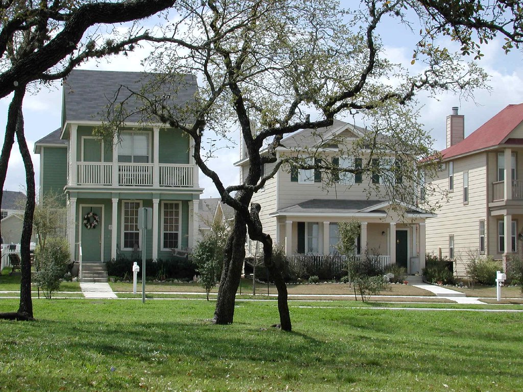
(Photo from Flickr user motus media.)


Links:

Shelby Farms to Be a "21st-Century Park" (Architectural Record)

America's Great 21st Century Park (CEOs for Cities)

Shelby Farms Park Alliance

Should the Landscape at the Arch Change? (STLtoday.com)

9.03.2007

Alaska From Above

While the hi-res satellite imagery on Google Earth is pretty fascinating, there is something to be said for the saturated, gauzy low-res views still aviailable when zoomed far enough out (or when hi-res is not available for a certain area) on good old-fashioned Google Maps. Especially over uninhabited areas, these bright, sometimes abstract images can have a sort of "lost world" mysterioso-vibe to them that I find particularly intriguing. But then, I still have an affinity for MS Paint, so I might just be an advanced Luddite, after all.

Still, for those who would disagree about the artistic power of crappy Crayola-toned satellite photos, I will make my argument with some rare (for this blog) color photos. These are taken directly from Google Maps, though I was not smart enough when snapping the shots with PrintScreen to save the url for each location. If you enjoy these, go do some Googlexploring of your own. Being that most of Alaska is untamed wilderness, it's a great place to start...


If you find any good stuff on your own (in Alaska or elsewhere) be smarter than I was -- post the url as a comment. Happy 'sploring.